Las Carboneras, Tenerife: Village Life, Mountain Views and Walks in Anaga
Las Carboneras sits among terraced fields and wooded slopes in Tenerife’s Anaga mountains. Its small square, traditional farming landscape and connections with Chinamada make it a rewarding stop for visitors who want to explore rural Anaga, whether on a short village visit or a longer walk.
In this guide
Where is Las Carboneras?
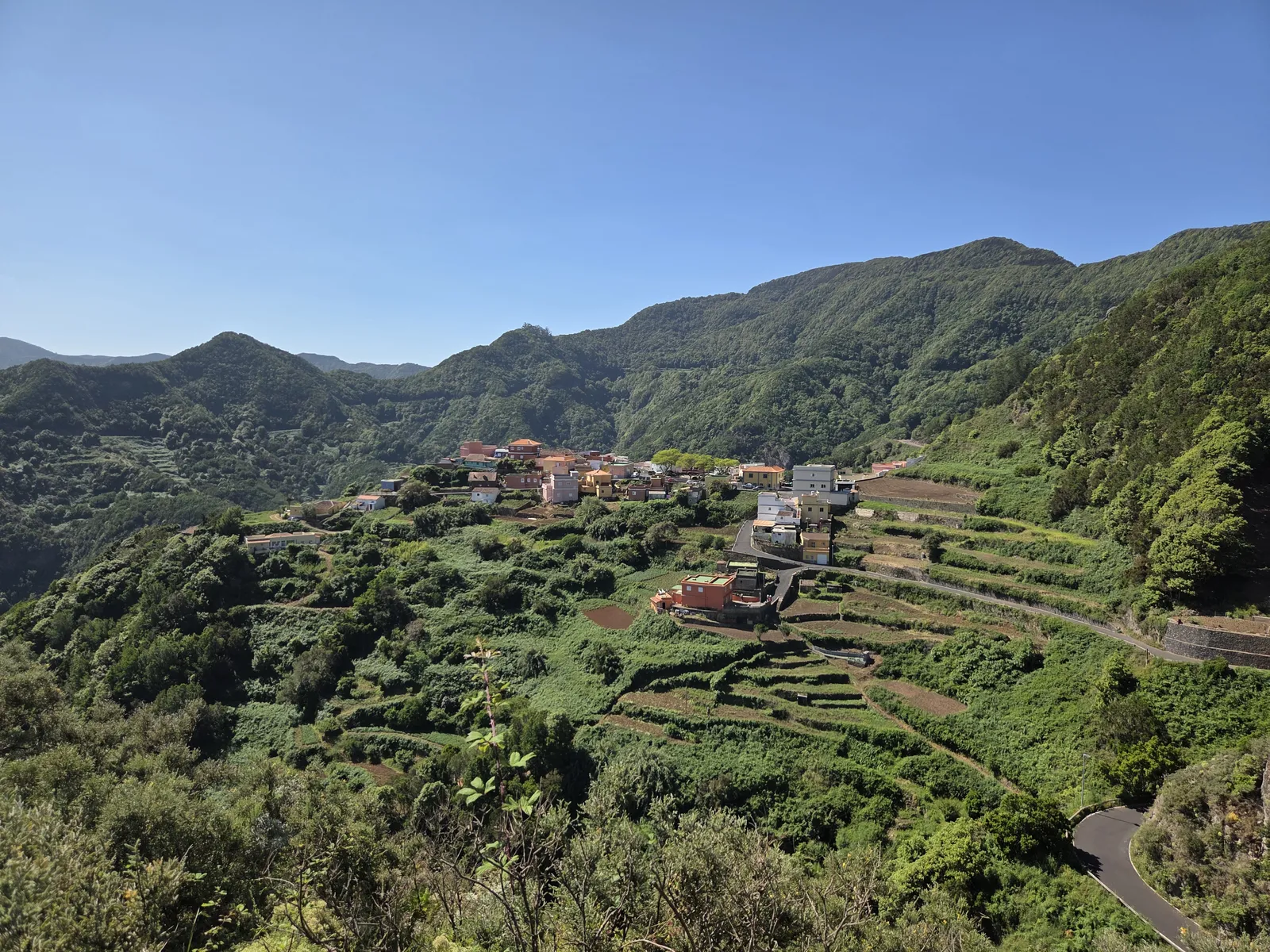
Las Carboneras is a hamlet within the municipality of San Cristóbal de La Laguna, on the northwestern side of the Anaga massif. It lies inside Anaga Rural Park, reached from the TF-12 mountain road by the TF-145. Despite belonging to La Laguna, its steep surroundings feel far removed from the city’s broad streets and historic squares.
The main attraction is the relationship between settlement and landscape: houses occupy limited patches of gentler ground, cultivated terraces step down the slopes, and woodland covers the higher ridges. Views towards the Barranco de Taborno help explain how deeply ravines divide this part of Tenerife.
Choose Las Carboneras for rural scenery and walking rather than a long sightseeing checklist. A brief stop reveals the village centre; exploring its paths gives a much better understanding of the terrain and the effort involved in farming it.
What to see in Las Carboneras
Plaza San Isidro and the village chapel
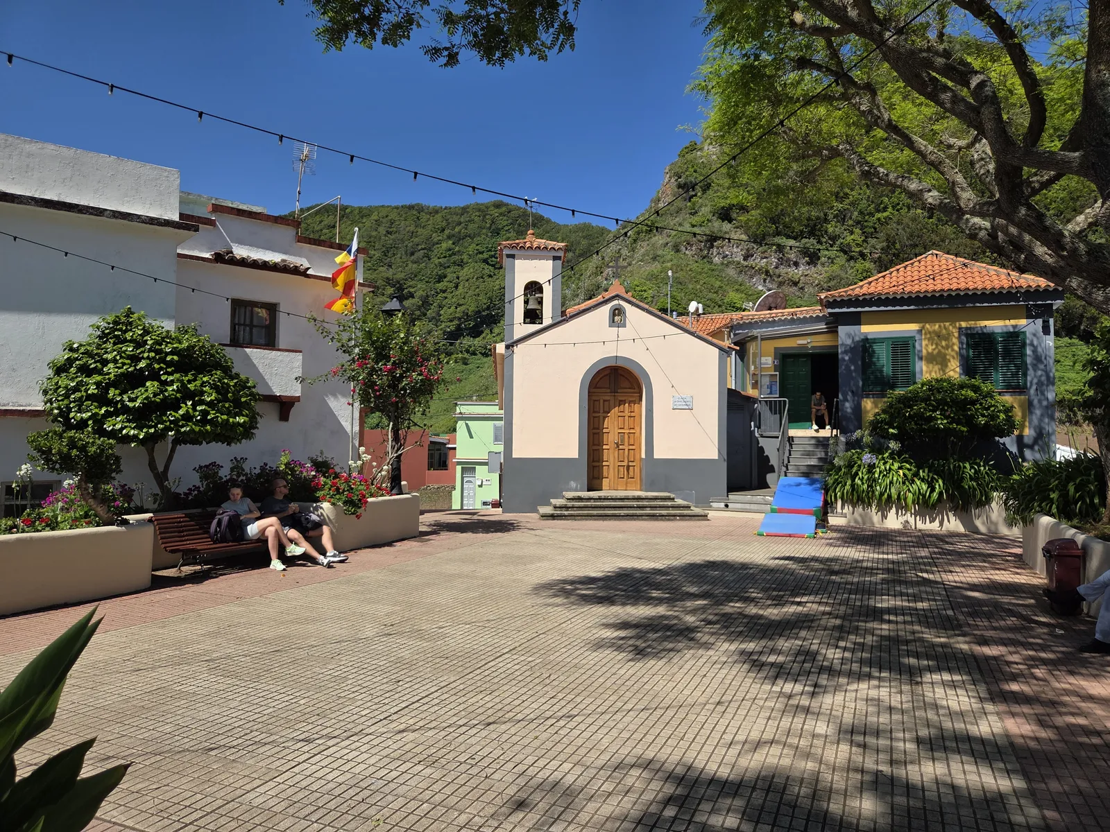
Plaza San Isidro is the natural starting point. The small chapel, neighbouring buildings, planted borders and benches form a compact village centre where you can pause before exploring. Enjoy the exterior even if the chapel is closed; do not plan around finding it open throughout the day.
The square remains a community space rather than a visitor attraction with fixed opening hours. Local celebrations can change its atmosphere considerably and bring temporary traffic or parking restrictions. Keep entrances clear and respect residents when taking photographs.
Terraces, traditional paths and ravine views
Beyond the square, the agricultural landscape deserves the most attention. Stone retaining walls create narrow cultivation platforms on otherwise difficult slopes. Paths connect homes, fields and neighbouring settlements, showing how movement through Anaga developed before road access became straightforward.
Appreciate the terraces from public paths without entering fields or climbing walls. Elevated views on the approach reveal the village’s setting, but a good photographic angle does not necessarily indicate a formal viewpoint or a safe stopping place. Drivers should stop only where the vehicle can stand legally and fully clear of traffic.
Walks from Las Carboneras
Choose your route before arriving: a local circuit, a connection to Chinamada and a descent to the coast involve very different commitments. Check current notices on Tenerife ON, and carry an offline map.
The local self-guided circuit
A self-guided walk explores the farming landscape around Las Carboneras, including paths towards the Barranco de Taborno. Published versions are approximately 2.5–3 kilometres, depending on the precise track. Allow around two hours with interpretation stops and breaks.
This is a useful choice for returning to the same village, but short distance does not mean level ground. Expect descent followed by a climb back, uneven footing and potentially slippery sections. Consult the official Las Carboneras self-guided booklet alongside current access information.
PR-TF 10.1 towards Chinamada
PR-TF 10.1 links Las Escaleras, Las Carboneras and Chinamada. Tenerife’s official tourism listing gives 3.1 kilometres and approximately one hour for the complete linear branch. Those figures are not a return walk starting in Las Carboneras; identify your actual starting point and turnaround before estimating the day.
This connection suits walkers interested in combining two rural settlements. Check the official PR-TF 10.1 description and distinguish the marked trail from the road connection.
Longer routes towards Afur or Punta del Hidalgo
PR-TF 9 connects Las Carboneras with Afur through the surrounding mountain landscape. It requires a separate hiking plan and return arrangements, rather than being treated as an extension of a village stroll.
Another option is continuing through Chinamada towards Punta del Hidalgo. The Chinamada-to-coast section alone is listed at 4.7 kilometres and around two hours fifteen minutes, with substantial descent on rugged terrain. Alternatively, approach Las Carboneras from Cruz del Carmen through the forest. Both options need transport planning; a downhill outward walk becomes a demanding climb if you must retrace it.
Chinamada and nearby places to combine
Chinamada is the most natural companion to Las Carboneras. Its inhabited cave houses add a different architectural perspective to the same mountain environment. These are private homes: view them respectfully from public areas rather than treating doorways or courtyards as exhibits.
Mirador de Aguaide is associated with Chinamada, not Las Carboneras itself. It offers a possible additional objective, but check access before including it: refurbishment of the viewpoint and surrounding paths has been approved. That announcement alone does not establish whether a particular path is open or closed on your visiting date.
Cruz del Carmen makes a useful forest stop on the approach, especially for visitors wanting a contrast with the cultivated slopes. Taborno is another nearby village option, but its Roque circuit is a separate mountain walk. For a relaxed half-day, choose Las Carboneras and Chinamada rather than trying to complete several substantial hikes.
Getting to Las Carboneras and parking
From La Laguna, approach through Las Mercedes towards Cruz del Carmen on the TF-12, then take the TF-145 turnoff for Las Carboneras. Expect bends, narrow sections and limited visibility. Allow time for the mountain drive, and avoid stopping on bends to photograph the scenery.
Parking space within the hamlet is limited. Use only permitted spaces, leaving room for buses, turning vehicles and access to homes. Do not assume the square or a roadside widening is available for parking, particularly during village events.
TITSA route 275 connects La Laguna’s interchange with Las Carboneras and Taborno. The order in which it serves the two villages varies by departure, so read the timetable notes carefully. Confirm the correct village stop and return journey rather than confusing Las Carboneras with an approach-road junction.
When to visit and how much time to allow
Allow roughly 30–60 minutes for the square and a short look around, longer if you enjoy photographing the terraces. Reserve a half-day for a local walk with breaks, or plan a full hiking day for a longer linear itinerary and its transport connections.
Bring water, food, shoes with good grip and a light waterproof layer. Do not depend on finding refreshments available at your arrival time. Cloud and rain can change both visibility and footing; check the AEMET forecast and postpone exposed routes in unsuitable conditions.
For a first visit, explore the square and choose one manageable walk. Las Carboneras rewards time spent noticing its working landscape more than a hurried stop between distant Anaga attractions.