Tegueste to Bajamar via Mesa de Tejina: From Valley Paths to Atlantic Views
The hike from Tegueste to Bajamar via Mesa de Tejina combines a traditional village start, a climb to an open panoramic plateau and a descent through rugged ravines to the Atlantic. It is a rewarding way to explore the western edge of Anaga, with agricultural landscapes, mountain paths and a seaside finish in one varied outing.
In this guide
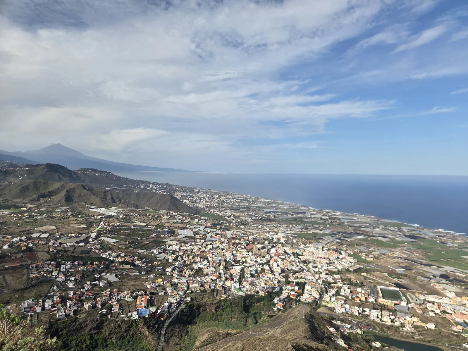
Route overview: a mountain walk with a coastal finish
This is a linear hike linking inland Tegueste with coastal Bajamar, adding the climb onto Mesa de Tejina along the way. Its appeal lies in the changing perspective: village streets give way to cultivated slopes, the plateau reveals the wider coastline, and the final mountain paths lead down towards the sea.
Allow roughly four to five hours for an unhurried outing with the plateau visit and breaks, then extra time for lunch or the waterfront. This is a planning allowance rather than a fixed official duration. Distance and accumulated ascent depend on the approach through Tegueste, the summit excursion and your chosen endpoint in Bajamar; check those figures on the exact track you intend to follow.
The route combines local paths with a final connection to the PR-TF 12 towards Bajamar. The complete PR-TF 12 begins at Cruz del Carmen, while PR-TF 12.1 connects that network with Tegueste. A Mesa de Tejina itinerary therefore needs its own mapped route: following signs towards Cruz del Carmen throughout would take you elsewhere.
Starting in Tegueste: San Marcos and the valley paths
Plaza de San Marcos is a convenient meeting point in Tegueste’s historic centre. The church, surrounding streets and village atmosphere deserve a little time before the climb. Buy water and food here, and organise your navigation before leaving the built-up area.
A traditional approach leaves the centre through the streets around La Audiencia and Puente de Palo, continuing towards the paths above the village. Other recorded itineraries start around Los Laureles. Choose one complete route and follow its approach consistently, rather than switching between descriptions with different starting points.
As you gain height, look back across Tegueste’s houses, fields and enclosing ridges. Old terraces and stone boundaries explain how closely these mountain paths were connected with everyday rural life. Keep to the established passage through cultivated areas and leave gates and walls undisturbed.
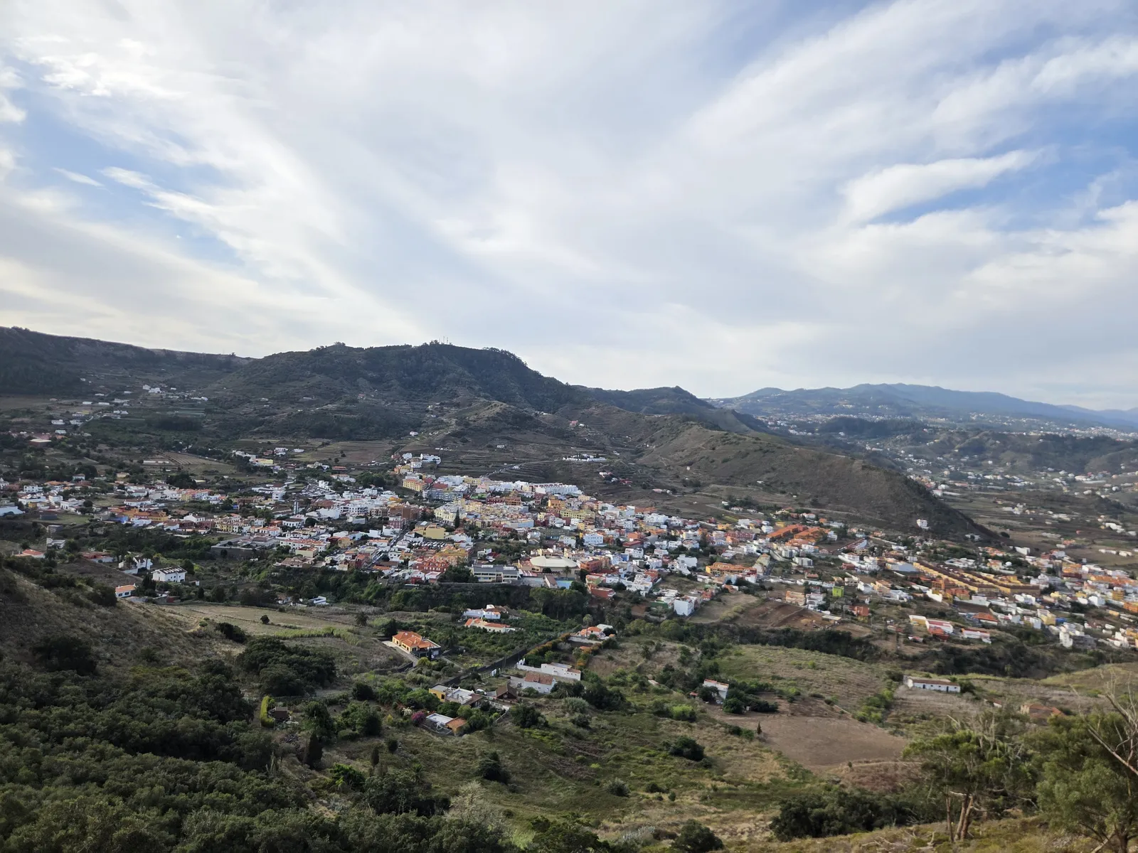
Climbing Mesa de Tejina and enjoying the panorama
Mesa de Tejina is the distinctive table-like mountain above the surrounding settlements, reaching approximately 590 metres. The Tegueste–Bajamar connection passes through the saddle area of La Degollada; reaching the plateau itself adds a separate climb. Include that excursion explicitly when choosing your walking track.
The approach becomes steeper and rougher near the upper ground. Take your time on uneven rock, especially where the path narrows. At junctions, distinguish the route onto the mesa from paths continuing towards La Orilla or descending towards Bajamar.
On a clear day, the reward is a wide view across Tegueste, Tejina and Valle de Guerra towards the Atlantic. Teide may appear farther west, while the surrounding slopes reveal the deeply dissected edge of Anaga. This is an open mountain viewpoint, with uneven ground and steep margins, so choose a comfortable stopping place back from the edge.
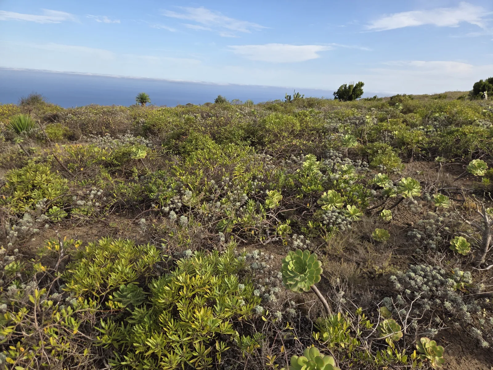
Low vegetation is another part of the plateau’s character. Succulent rosettes and scrub occupy the rocky ground, with their appearance changing through the seasons. Follow the existing path across the summit area to avoid trampling plants, then retrace the summit access to the connecting route.
Descending through the ravines to Bajamar
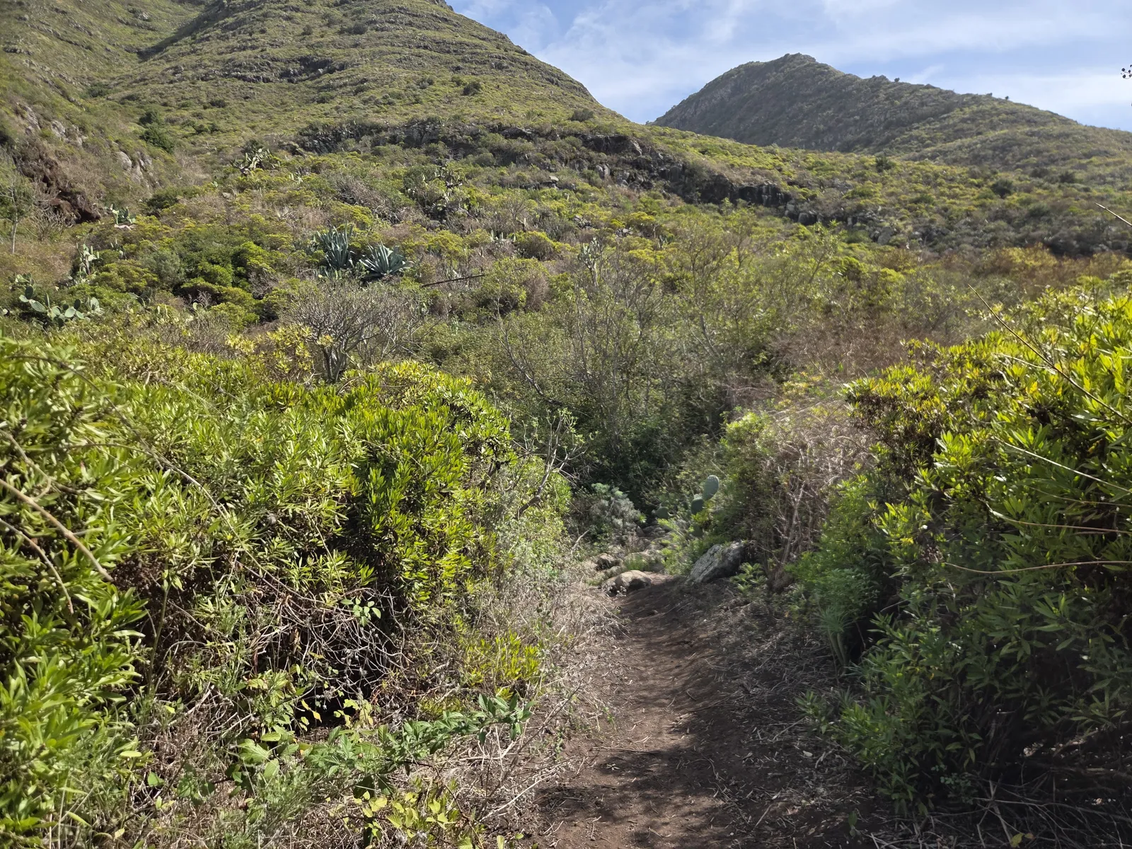
After the mesa excursion, continue on the established connection towards Bajamar. The mountain section traverses slopes and crosses folds in the terrain before meeting the PR-TF 12 in the La Goleta area. Expect changes of gradient: a coastal destination does not mean uninterrupted downhill walking.
This stretch brings a closer view of the ravines, layered rock and vegetation on the western side of Anaga. Some paths are narrow, and loose stones require attention even in dry weather. Resist shortcuts down gullies or across old terraces; the established route provides the intended connection between successive slopes.
On joining the PR-TF 12, follow the Bajamar direction and continue down into the settlement. Allow time for the streets between the mountain exit and the waterfront. Bajamar’s seawater pools and promenade make a satisfying finish, with places to eat nearby. Swimming depends on conditions: respect flags, barriers and lifeguard instructions, particularly when Atlantic swell reaches the pool walls.
Difficulty, weather and what to bring
Treat this as a moderate mountain outing for walkers comfortable with sustained climbing, rough descents and occasional exposure. The mesa ascent and narrow traverses require more confidence than a straightforward village walk. Wet rock, muddy sections, strong wind or poor visibility can make the same terrain substantially harder.
Choose a day with a clear forecast and moderate temperatures. Much of the route is exposed to sun, while cloud can obscure the plateau and wind can be stronger above the valley. Carry drinking water for the whole hike, food, sun protection, a light windproof layer and footwear with reliable grip. Walking poles can help on the descent.
Download your chosen track and map for offline use. Before setting out, check the route information and current restrictions through Tenerife ON, alongside the weather forecast. Follow any on-site closure signs; old route recordings do not establish present access conditions.
Getting there and planning the return
Public transport suits this linear walk particularly well. TITSA route 050 connects La Laguna with Tegueste, Tejina, Bajamar and Punta del Hidalgo. Route 105 also links Santa Cruz with Tegueste and Bajamar. Check the timetable for your travel day, the stop location and the direction before boarding.
If driving, park legally in Tegueste and plan the bus journey back from Bajamar. Alternatively, leave the car at the coastal finish and take the bus to Tegueste before walking. Avoid relying on the final service of the day.
An early start leaves time for the climb, a relaxed stop on Mesa de Tejina and lunch beside the sea. Keep the waterfront as the day’s natural conclusion: the contrast between Tegueste’s inland valley, the open plateau and Bajamar’s Atlantic shore gives this hike its particular character.