Roque Bermejo Beach: Walking from Chamorga to Tenerife’s Remote Anaga Coast
Roque Bermejo combines a dark volcanic beach, a small coastal hamlet and the rugged scenery of northeastern Tenerife. Reaching it is part of the experience: with no road down to the shore, most visitors walk from Chamorga through Anaga’s steep landscape. Come for a rewarding coastal hike, with time to explore the settlement and rest beside the Atlantic before climbing back.
In this guide
Where is Roque Bermejo?
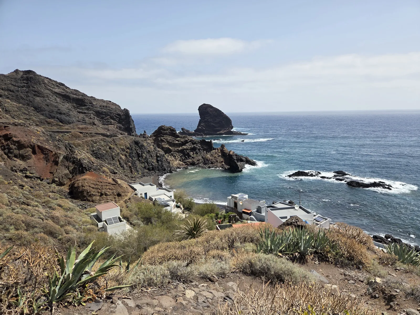
Roque Bermejo lies near the northeastern tip of Tenerife, within Anaga Rural Park and the municipality of Santa Cruz de Tenerife. Its few houses occupy the lower slopes around the mouth of the ravine descending from Chamorga. Above the coast stands Faro de Anaga, the lighthouse that forms a landmark on longer walks through this remote corner of the island.
The setting differs sharply from Tenerife’s resort beaches. There is no seafront road or promenade: paths, terraces, rocky slopes and scattered buildings shape the approach. Roque Bermejo is particularly rewarding if you enjoy combining a substantial walk with a coastal destination. If your priority is an easy swim with convenient facilities, Las Teresitas is a more practical choice.
What is Roque Bermejo Beach like?
The beach has dark volcanic sand, pebbles and a rugged rocky backdrop. Offshore rocks and the irregular shoreline give it a distinctive appearance, while the amount of exposed sand and the space available beside the water vary with sea conditions. Bring something comfortable to sit on, and keep belongings above the reach of incoming waves.
The official Spanish tourism beach listing describes an isolated beach approximately 120 metres long, accessible on foot or by boat. It also notes a breakwater that reduces wave action locally. That shelter should not be interpreted as a guarantee of calm water: swell, currents and conditions around the rocks still matter.
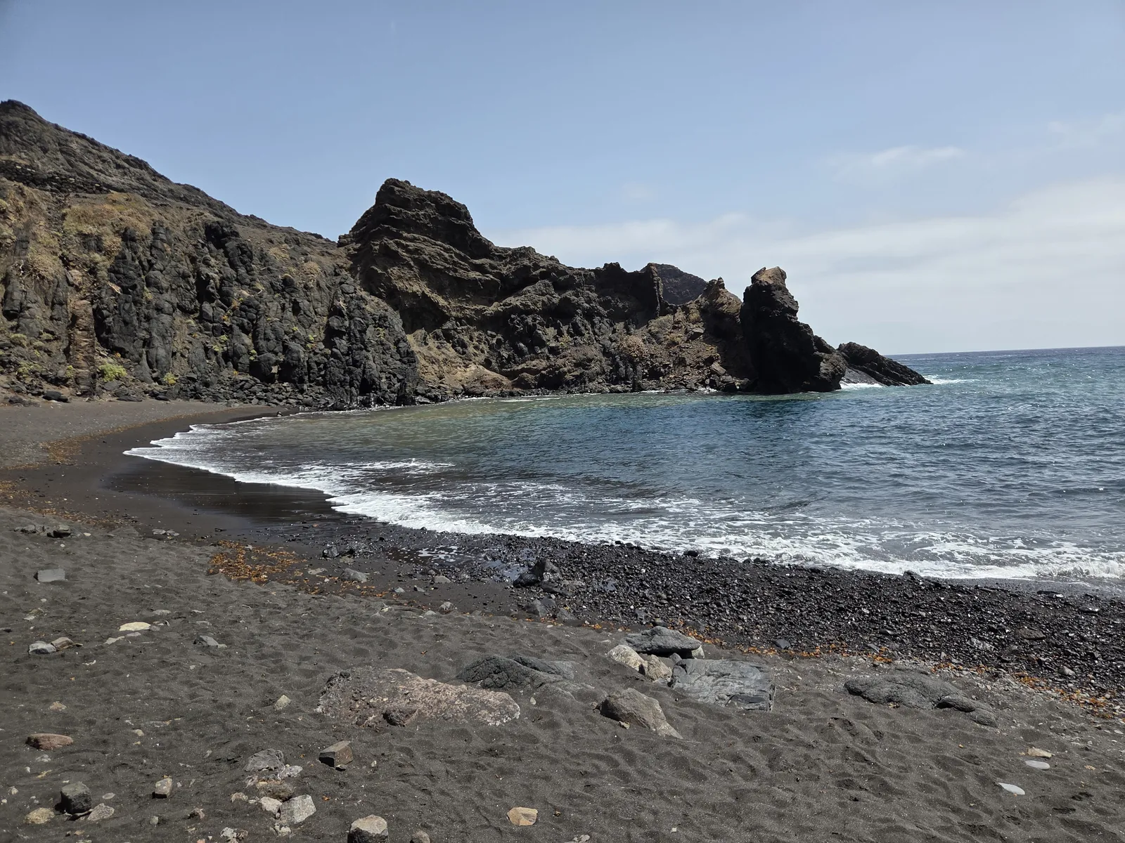
Assess the sea when you arrive, and stay out if waves are breaking strongly or entry and exit look uncertain. Do not assume lifeguard supervision will be available. A swim is an optional part of the day, rather than a reason to continue into unsuitable conditions. Save enough energy for the uphill return, especially after prolonged sun exposure.
Walking from Chamorga to Roque Bermejo
For a first visit focused on the beach, the most straightforward plan is to descend from Chamorga along the established ravine route and return the same way. This uses part of the PR-TF 6 trail network. The walk links the inland village with the coast through changing scenery, gradually leaving the higher slopes behind as the ravine opens towards the sea.
Treat it as a mountain walk with a beach stop. The path includes uneven stone, steps and sustained changes in height; the demanding climb comes after your time at the shore. It is unsuitable for pushchairs or wheelchairs, and walkers should be comfortable descending and climbing rough paths.
As a planning allowance, reserve around five to six hours for an unhurried return outing with breaks, adjusting this to your chosen track, fitness and conditions. This is not an official duration for every itinerary labelled “Roque Bermejo”. Check the distance and elevation profile of the exact route you intend to follow, and leave a generous margin before darkness or your return bus.
Returning via Tafada and Faro de Anaga
A different option combines the ravine path with the higher route through Casas de Tafada and Faro de Anaga, using PR-TF 6.1 and connecting sections. This offers a broader view of the coastline, but adds exposed mountain terrain and more demanding route planning. Choose it for the hiking experience, rather than as an incidental detour from the beach.
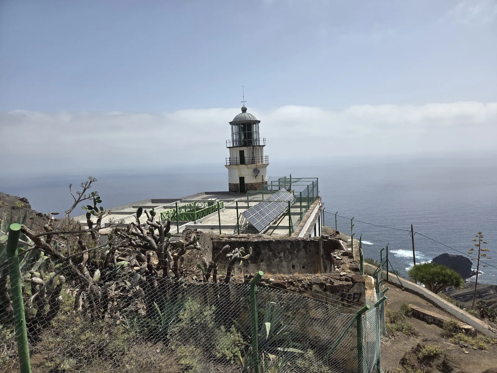
Longer itineraries extending towards Las Palmas de Anaga and El Draguillo are a separate undertaking. Do not confuse their distances or walking times with a direct Chamorga–Roque Bermejo return. Consult the Anaga Biosphere Reserve trail information and check current notices through Tenerife ON before setting off.
The coastal hamlet and Faro de Anaga
Leave time to appreciate the settlement itself. Small houses, stone walls, palms and a modest chapel give Roque Bermejo a human scale beneath the surrounding mountains. These are lived-in spaces, so stay on public paths, avoid entering terraces or gardens, and keep noise low around homes.
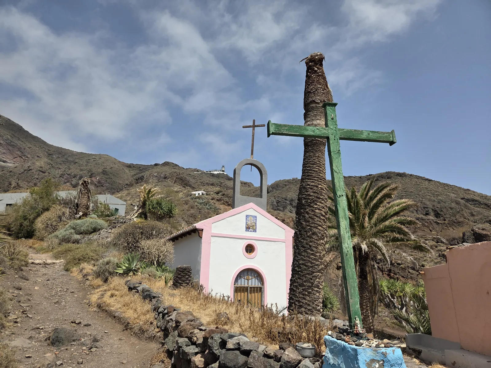
The lighthouse occupies higher ground above the hamlet, so reaching it requires additional climbing. Seeing it from below and walking up to its surroundings are different plans. Include the climb in your itinerary from the outset, and enjoy the exterior landscape without assuming access to the lighthouse buildings.
Getting to Chamorga by car or bus
Chamorga is reached by the winding TF-123 through eastern Anaga. Allow time for slow driving, bends and reduced visibility if cloud settles over the higher ground. Parking in the village is limited: use permitted spaces and leave entrances, turning areas and access for residents clear. Your car stays in Chamorga while you continue on foot.
TITSA route 947 connects Santa Cruz’s interchange with Chamorga via San Andrés and the Anaga mountains. Departures are limited and differ between weekdays and weekends. Check both directions before travelling, allowing enough time for the climb back rather than planning around your fastest possible pace.
Boat access is possible, but do not assume there is a regular passenger ferry or an available return transfer. Any private arrangement needs confirmation in advance and depends on suitable sea conditions.
When to visit and what to bring
Choose a day with moderate temperatures, manageable wind and no significant rain or coastal warnings. Conditions can differ between Chamorga and the shore: cloud higher up does not necessarily mean a cool walk along the exposed lower slopes. After rain, take particular care on wet stone and avoid entering a ravine during heavy rainfall.
Carry drinking water for the whole outing, food, sun protection, hiking footwear and a light weatherproof layer. Do not depend on finding an open shop, restaurant, drinking-water point or public toilet at the beach. Save your map offline, charge your phone and tell someone your route; mobile coverage should not be your only means of navigation.
For most first-time visitors, the direct return walk with a relaxed beach and hamlet stop makes a satisfying day. Start early, set a realistic turnaround time and take all rubbish back with you. Roque Bermejo is best enjoyed when the walk, the coast and the return climb all have their place in the plan.