Palm-Mar to Los Cristianos: Walking Across Mesas de Guaza
The walk from Palm-Mar to Los Cristianos crosses a rugged volcanic headland with open sea views, dry scrubland and a rewarding approach to Los Cristianos Bay. It is a proper coastal hike, with rocky climbs and uneven descents, rather than a continuous seaside promenade. Choose your route carefully and it makes an enjoyable half-day outing between two very different corners of southern Tenerife.
In this guide
Palm-Mar to Los Cristianos: distance, time and route options
Palm-Mar lies on the southeastern side of the Guaza headland, while Los Cristianos occupies the bay to its northwest. Walking between them means crossing the intervening volcanic terrain. The most relevant route for a coastal outing uses the lower plateau of Mesas de Guaza; climbing the much higher Montaña de Guaza summit is a separate extension.
For planning, allow approximately 4–6 km and 2–3 hours one way, depending on your starting street, chosen paths and finishing point. These are broad allowances rather than measurements of a single waymarked itinerary. Continuing to the harbour or bus stops adds urban walking, and the summit variant adds substantially more climbing.
Paths across the headland form a network, so download a map and a track matching the crossing you intend to make. A route labelled simply “Guaza” may lead towards the summit, a circular hike or a different coastal approach. For a first visit, a straightforward one-way crossing leaves time to enjoy Los Cristianos afterwards.
Walking from Palm-Mar to Los Cristianos
Leaving Palm-Mar
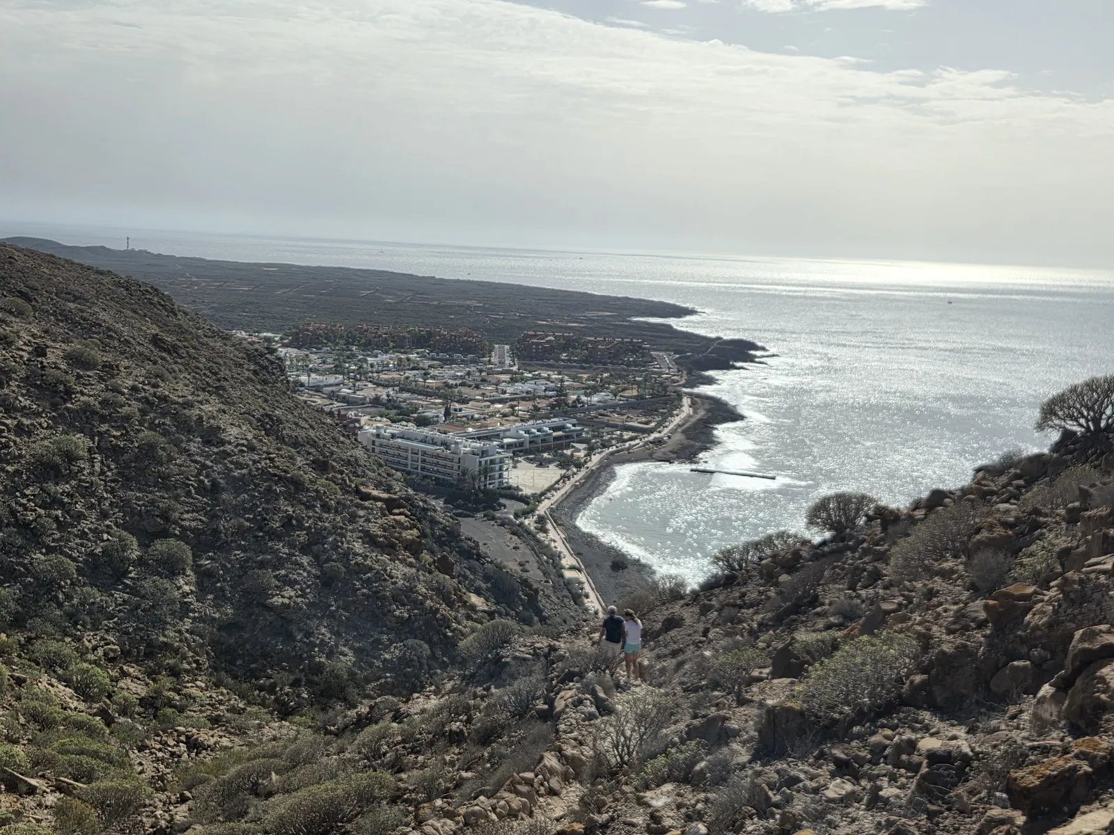
Make your way towards Palm-Mar’s northern coastal edge, where the built-up area meets the rocky slopes of Guaza. La Arenita beach provides a useful orientation point, but the onward hike climbs above the coast: there is no level promenade running around the headland to Los Cristianos.
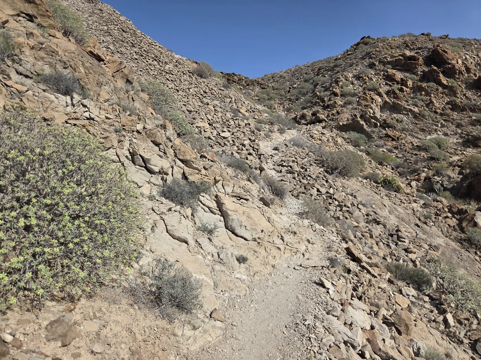
The ascent from the Palm-Mar side is one of the sections requiring the most attention. Expect rough rock, loose stones and a narrower tread than the broad paths above. Follow your selected track and the established path, checking junctions before committing to a traverse. Avoid shortcuts towards the cliff edge.
Crossing Mesas de Guaza
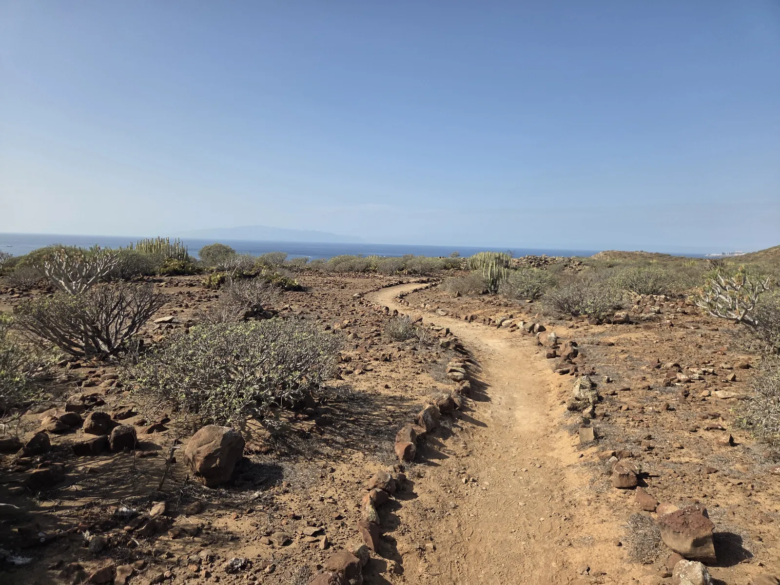
Above the initial climb, the landscape becomes more open. Sandy stretches alternate with exposed stone, and low vegetation leaves wide views across the plateau. This is a good place to settle into a comfortable pace, although branching tracks mean navigation still matters. Stay with the crossing towards Los Cristianos rather than following an uphill branch towards Montaña de Guaza.
Descending into Los Cristianos
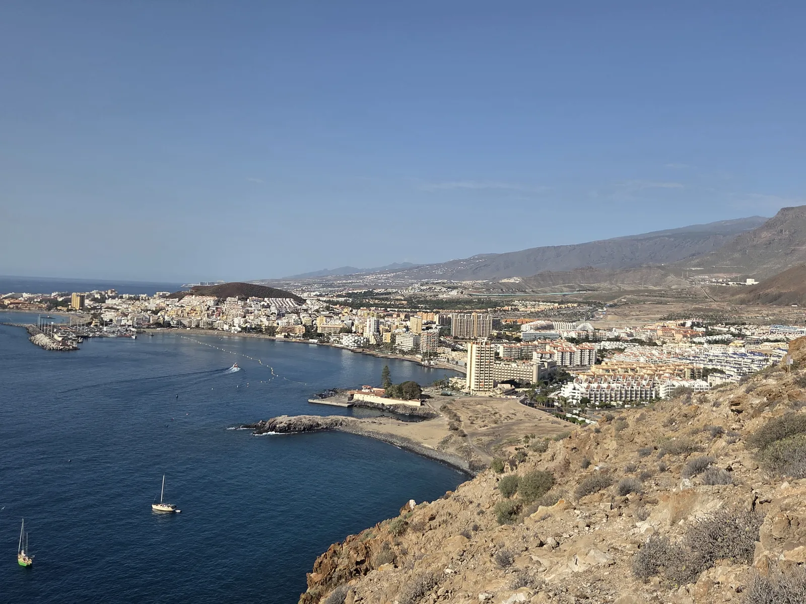
The final approach brings the bay and waterfront buildings into view. Descend carefully on the uneven paths towards the eastern end of Los Cristianos, around the Los Callados side of the waterfront. From there, continue along the seafront past Los Tarajales towards the main beach and harbour. The change from dry volcanic ground to a busy resort promenade is part of the walk’s appeal.
What makes the Guaza crossing worthwhile?
The main attraction is the contrast between the two settlements and the undeveloped terrain separating them. Palm-Mar’s shoreline recedes behind you, while Los Cristianos gradually appears around the headland. On clear days, the ocean horizon and the distant outline of La Gomera add depth to the coastal views.
Mesas de Guaza and Montaña de Guaza are related but distinct landforms: the lower lava plateau provides the coastal crossing, while the prominent mountain rises inland. Together they belong to the protected Montaña de Guaza Natural Monument. The route passes through sparse vegetation adapted to dry conditions, with rocky ground that is easily damaged by repeated shortcuts.
Enjoy the views from stable ground, leaving space between yourself and exposed edges. Keep to existing paths, leave rocks and plants undisturbed, and give wildlife room. The plateau deserves time in its own right; reaching the mountain summit is not necessary for a satisfying walk.
Difficulty, footwear and weather
This crossing suits walkers comfortable on rough trails and short, steep sections. Its modest distance can be misleading: loose footing, exposed stretches and strong sunshine make it more demanding than a resort walk. Some passages may require a steadying hand, depending on the line followed. It is unsuitable for pushchairs or anyone needing a smooth, step-free surface.
Wear walking shoes with reliable grip and carry water, sun protection and an offline map. There is little shade and no dependable refreshment stop between the settlements. Walking poles can help on loose descents, provided you are comfortable using them on narrower ground.
Start early during warmer weather and avoid the crossing in strong wind or poor visibility. Rain can make rock slippery. Check the AEMET forecast for Arona and follow any local access notices. With children, judge their experience on exposed terrain rather than their ability to cover the distance.
Getting there, parking and the return journey
A one-way hike needs a return plan. A taxi provides a simple road transfer between Los Cristianos and Palm-Mar; confirm the fare or charging basis before travelling. If driving to Palm-Mar, use permitted street parking and keep residential entrances clear.
For public transport, TITSA line 468 serves Palm-Mar and Guaza. A journey to or from Los Cristianos generally requires a connection, rather than staying on this bus throughout. Check the complete trip using the TITSA journey planner, including the walking distance to your stop.
Check service alerts as well as timetables: roadworks can change the stops served inside Palm-Mar. Do not base the return on an old hiking description naming a particular beachside stop. Retracing the trail is another possibility, but doubles the walking and repeats the rocky sections.
A realistic half-day plan
Begin in Palm-Mar in the morning, allow an unhurried 2–3 hours for the crossing, then continue along the Los Cristianos waterfront for lunch. Arrange the return with enough flexibility for photographs, navigation checks and a slower descent.
If you want a longer outing, choose a mapped summit itinerary in advance rather than adding Montaña de Guaza spontaneously. Punta de Rasca, south of Palm-Mar, belongs to a different coastal walk and adds considerable distance. For a first crossing, the plateau route followed by time beside Los Cristianos Bay offers a balanced mix of hiking, views and an easy finish.