Malpaís de Güímar: Walking Through Tenerife’s Volcanic Coastal Reserve
Malpaís de Güímar brings together rough lava fields, a reddish volcanic cone and an Atlantic shoreline where waves break against black rock. Just beyond Puertito de Güímar, this protected landscape offers a rewarding coastal walk, with routes ranging from a short shoreline outing to a longer circuit around Montaña Grande.
In this guide
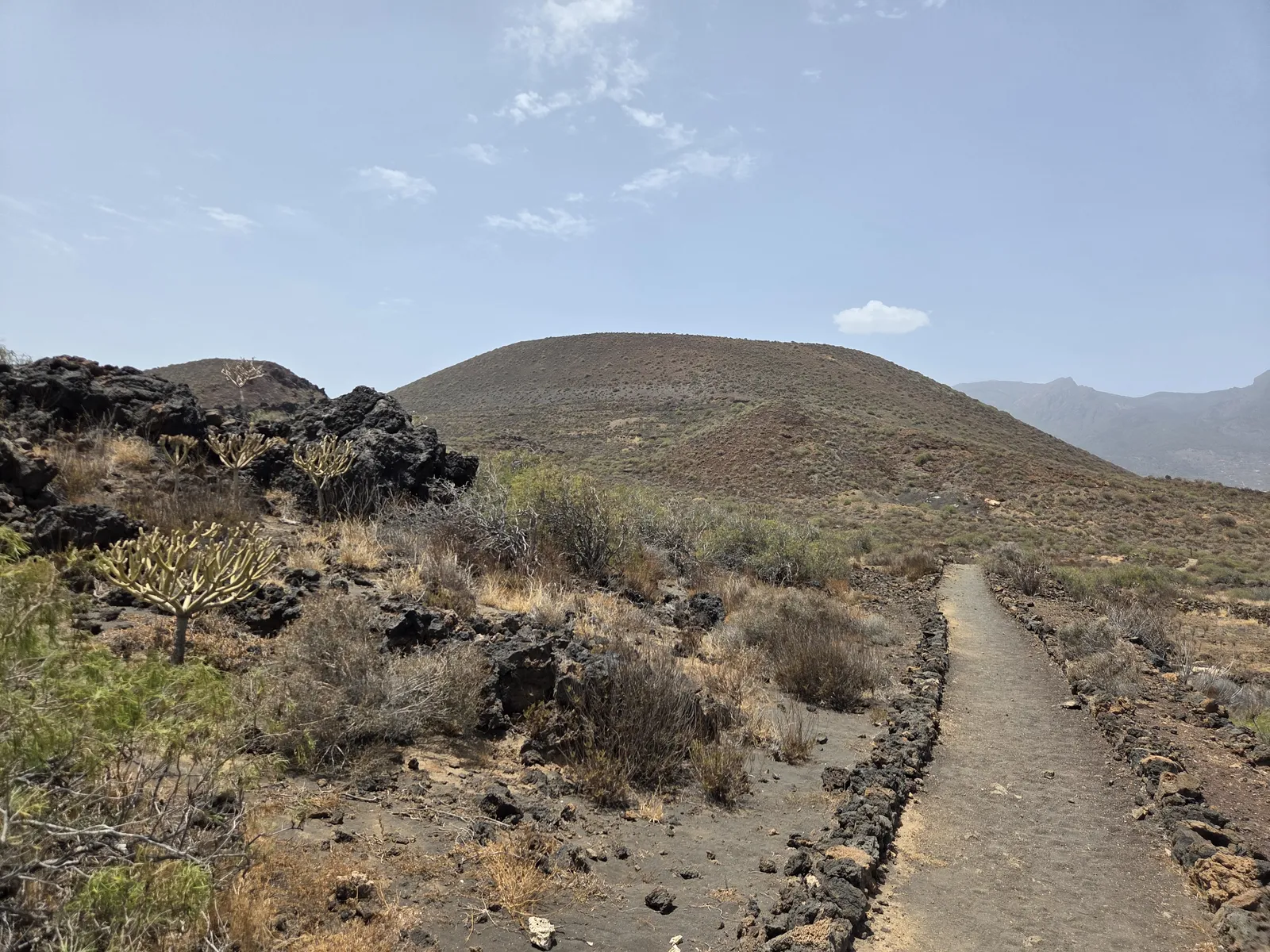
A volcanic landscape between Montaña Grande and the sea
The Reserva Natural Especial del Malpaís de Güímar lies on Tenerife’s eastern coast, between Puertito de Güímar and El Socorro. Its defining feature is the contrast between the rounded outline of Montaña Grande and the broken lava extending towards the ocean. The Spanish word “malpaís” describes this difficult volcanic ground: angular blocks, ridges and cavities that make walking away from established paths both awkward and damaging.
This is a landscape best appreciated slowly. From a distance, the lava can appear almost uniform; close up, changes in texture, colour and vegetation reveal a much more varied environment. Inland paths give a broader view of the volcanic cone, while the coastal stretches bring the sound of the surf and the contrast of white water against dark basalt.
For a first visit, choose a route combining both environments. Walking only beside the sea misses some of the reserve’s volcanic character, while staying inland leaves out its most dramatic coastal scenery.
The main circular walk from Puertito de Güímar
A useful reference is the Malpaís de Güímar 1 circular route, published by Tenerife’s official tourism website. It starts and finishes on Calle Almirante Cervera in Puertito de Güímar and is listed at 6.11 kilometres, approximately three hours and 169 metres of accumulated ascent. These figures describe that particular itinerary; alternative combinations through the reserve will produce different totals.
The circuit combines the interior lava landscape with the shoreline, offering more variety than a simple coastal out-and-back. Follow the mapped route and junction signs rather than treating every visible track as an interchangeable shortcut. Download the route before leaving and compare it with the information panel at the entrance.
Allow time for pauses without assuming that the modest distance makes this a quick stroll. Uneven ground slows progress, and the exposed conditions can feel demanding even when the gradients are gentle. Three hours is a sensible starting point for planning; photographers and walkers taking longer breaks should allow more.
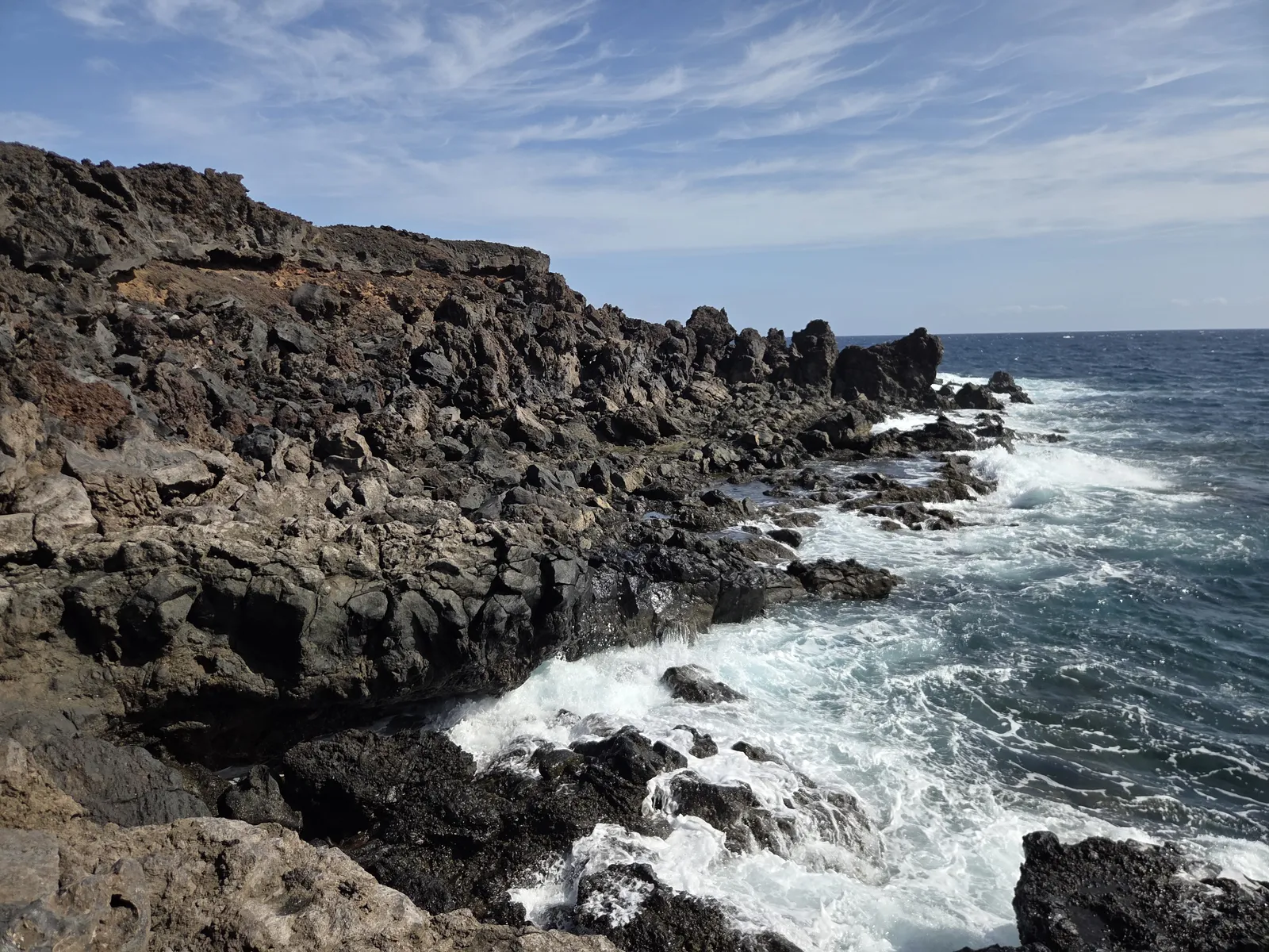
Beside the sea, enjoy the views from the path. The rocky shoreline is part of the walk’s appeal, but it should not be treated as a convenient swimming stop: slippery surfaces, difficult exits and breaking waves make scrambling down to the water a poor addition to the itinerary.
Longer and shorter ways to explore
Extend the walk around Montaña Grande
The official Malpaís de Güímar 2 route skirts Montaña Grande and connects two points of the main circuit. It is listed as a 2.7-kilometre linking route taking about one hour. Because it replaces a section of the original itinerary, calculate the combined distance from your chosen map rather than simply adding both published totals.
This option suits walkers who want more time with the volcanic landscape. A route around the mountain does not automatically include a summit ascent: do not follow an informal uphill track simply because it appears on a downloaded recording. Check current access rules before planning any climb beyond the signed circuit.
Start from El Socorro or choose a shorter outing
The Malpaís de Güímar 3 connection begins on Avenida Marítima in El Socorro and reaches the main route. Its published 1.87 kilometres and 45 minutes are for the connection, not an entire return excursion. It offers an alternative approach, especially if you want to include El Socorro, but requires a clear plan for returning.
For a shorter visit, walk a manageable distance from Puertito along the designated coastal path and return the same way. Set a turnaround time before starting. This retains the shoreline experience without committing to the full circuit, although the rocky surface still requires suitable footwear.
Plants, wildlife and traces of coastal life
The reserve is far from lifeless. Cardones and tabaibas are characteristic plants of its dry landscape, while vegetation closer to the sea must cope with salt spray, wind and limited soil. Look for plants rooted in cracks and pockets between the lava blocks, and for lichens adding subtle colour to rock surfaces.
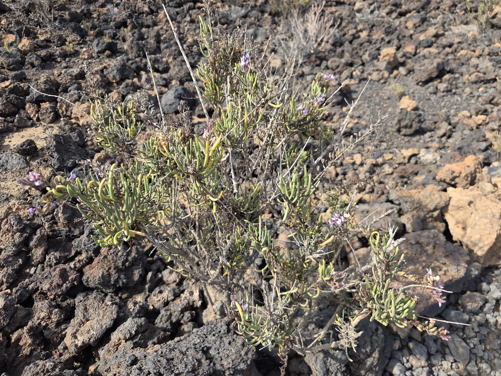
Lizards and birds add movement to the open terrain. Staying quiet and pausing often is more rewarding than searching off the path. Do not pick plants, remove stones or disturb animals; avoid touching unfamiliar succulent plants, some of which contain irritating sap.
The coast also preserves evidence of traditional salt gathering and other uses of marine resources. Volcanic cavities are another important feature beneath the surface, but they are not an invitation to explore underground. Cueva Honda, also called Cueva de los Burros, is specifically described as not visitable in the official route information.
Difficulty, weather and what to bring
The official main circuit is rated moderate. Its challenge comes principally from rough footing, sun exposure and the cumulative effort of crossing uneven ground. It is unsuitable for pushchairs or standard wheelchairs. Families with children accustomed to walking may enjoy it, provided they choose an appropriate distance and supervise them near the shoreline.
Start early, particularly during warmer months. There is little dependable shade, and a sea breeze can disguise how much sun you are receiving. Cooler days are generally more comfortable, but check wind, heat and coastal conditions in every season.
- Wear closed walking shoes with a grippy sole.
- Carry enough water for the entire outing, plus a reserve.
- Bring a hat, sunscreen, food and a charged phone with an offline map.
- Stay on designated paths and carry all rubbish back out.
Before travelling, consult Tenerife ON for relevant notices and respect entrance signs or temporary restrictions. Do not rely on an older walking report as confirmation of present conditions.
Getting there and making a half-day visit
For the Puertito start, approach from the TF-1 and follow signs to Puertito de Güímar. Find a legal parking space in the town, then walk to Calle Almirante Cervera and the reserve entrance. Leave access roads and residential entrances clear, and allow extra time for parking on busy beach days.
Public transport is practical from Santa Cruz and Candelaria: TITSA line 120 serves Puertito de Güímar and Güímar. Check the current timetable, your nearest stop and the return service before setting out.
Buy supplies in town rather than expecting refreshments along the trail. An early circuit followed by lunch on Puertito’s waterfront makes a comfortable half-day plan. Choose the shorter coastal outing if time or temperatures are limiting; choose the Montaña Grande extension when conditions and your energy allow a longer exploration.