Igueste de San Andrés to El Semáforo: Coastal Hiking in Tenerife
The walk from Igueste de San Andrés to El Semáforo combines a traditional coastal village, a sustained climb through volcanic slopes and an old maritime signal station overlooking the Atlantic. This short out-and-back route offers a different side of Anaga: open hillsides, rocky paths and sea views rather than shaded laurel forest.
In this guide
Igueste and the coastal setting
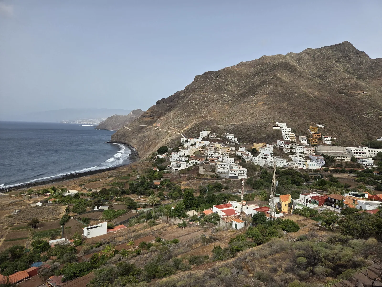
Igueste de San Andrés lies beyond San Andrés on the southeastern coast of the Anaga massif, within the municipality of Santa Cruz de Tenerife. Make sure you select this village when planning your journey: Igueste de Candelaria is a different place elsewhere on the island.
White houses climb the valley sides above cultivated plots and the shoreline. Before starting the hike, allow a little time for the pedestrian lanes around the Church of San Pedro Apóstol and the lower village. These are residential spaces, so keep entrances clear and respect the privacy of homes beside the path.
The setting helps explain the appeal of the walk. As you gain height, the village becomes a compact cluster between mountain and sea, while the coast opens towards San Andrés. Unlike Anaga’s forest walks, this route reveals the drier coastal landscape and the relationship between settlement, farming and maritime activity.
The route to El Semáforo
Follow the signs for PR-TF 5.1 and El Semáforo from Igueste. The official tourism listing gives approximately 2.2 kilometres and one hour for the outward journey. Returning along the same path makes the basic excursion around 4.4 kilometres; allow roughly two to three hours overall, including pauses at the station.
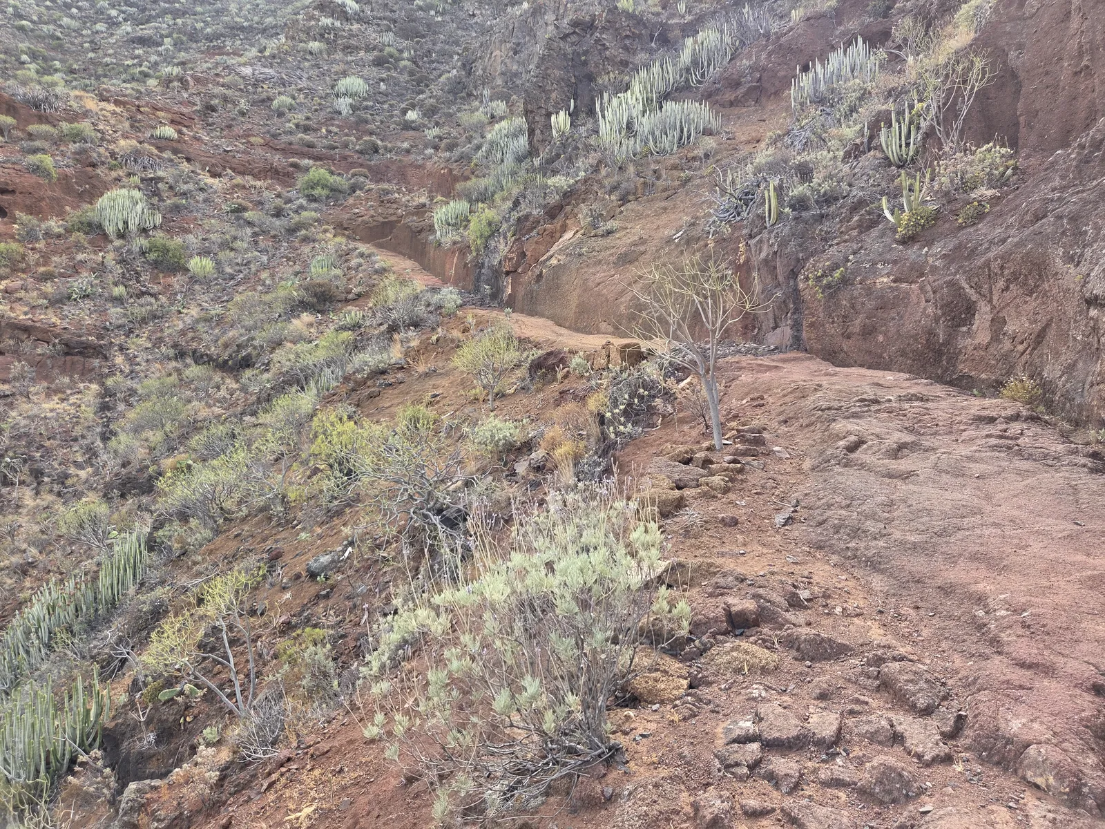
The path climbs the slopes of Montaña de Las Toscas, with stretches cut into the rock. Its short distance can be deceptive: the outward route includes approximately 347 metres of accumulated ascent and 129 metres of descent. You therefore climb above the destination before descending towards it, and must regain that height on the return.
Walk steadily through the initial ascent rather than treating it as a quick approach to a viewpoint. The changing perspective over Igueste is part of the experience, and frequent short pauses make the climb more comfortable in warm weather.
Return by the marked approach. El Semáforo is not a road-accessible endpoint with transport waiting nearby. Other paths in this part of Anaga should not be assumed to form an easy coastal loop, and the connection towards Chamorga is a separate mountain itinerary requiring substantially more time and planning.
The maritime signal station
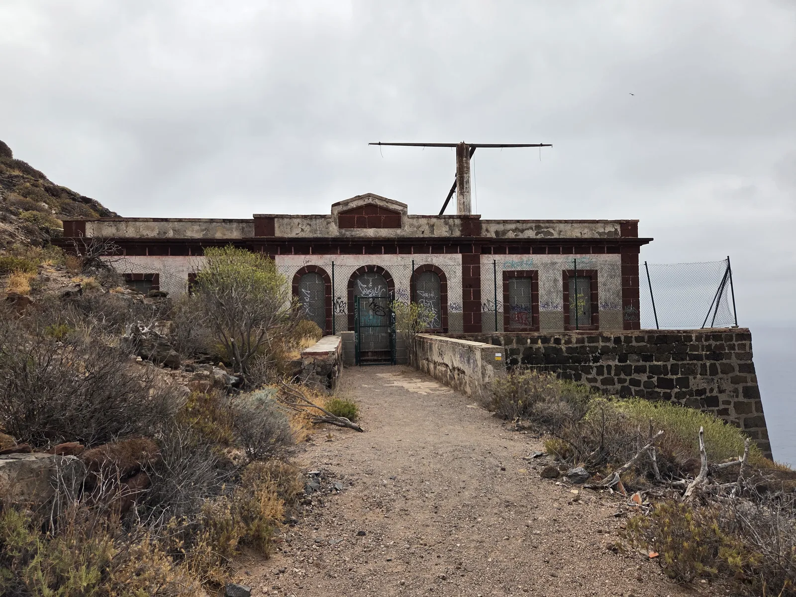
El Semáforo, also known as the Semáforo de Anaga, belonged to the maritime communications network that watched vessels approaching Santa Cruz. Its elevated coastal position allowed observers to see shipping well before it reached the harbour and relay information between ships and shore.
The name refers to a signalling station, not a road traffic light. Flags and telecommunications were part of a system that connected observations at this remote outpost with activity in the port. The building also belongs to a longer history of lookout posts across Anaga.
Today, the weathered façade and remaining structures give the destination its character. Appreciate them from outside: deteriorated masonry and damaged interiors should not be treated as safe visitor spaces. Keep away from cliff edges and avoid climbing walls or entering unstable parts of the building.
For more historical context, Igueste has a separate interpretation centre devoted to El Semáforo and the lookout posts, inaugurated in December 2024. The municipal project information identifies its location at CEIP José Pérez Rodríguez. Confirm visiting arrangements before including it in your day; the village exhibition and the hillside station are different places.
Difficulty and preparation
The official tourism description rates PR-TF 5.1 as low difficulty, but that should be read alongside the gradient and surface. This is a mountain footpath with uneven footing, exposed sections and considerable climbing for its length. It suits walkers comfortable with sustained uphill walking, rather than visitors expecting a level seaside promenade.
Wear walking shoes with reliable grip. Loose material and irregular rock require attention on the descent, especially when tired. The route is unsuitable for wheelchairs or pushchairs; families should judge children’s experience and ability to follow instructions around exposed ground.
Choose a mild day and begin early during hot weather. Open slopes offer limited protection from the sun, while strong wind can make exposed sections uncomfortable. Carry enough water for the complete return journey, a snack, sun protection and an extra layer. Do not depend on finding refreshments at the destination.
Check the official route information and current notices on Tenerife ON before setting out. The tourism listing states that no route-specific authorisation is required, but temporary restrictions and weather warnings still apply.
Getting there and parking
By car
Approach through San Andrés and continue along the TF-121 to Igueste de San Andrés. The winding coastal road deserves an unhurried drive. Leave the car in a legal space in the village, keeping driveways, pedestrian access and bus manoeuvring areas clear. Allow extra time to find a space rather than relying on parking immediately beside the trail entrance.
By public transport
TITSA bus 945 connects Santa Cruz’s interchange with Igueste through San Andrés. Check the timetable for your travel day and choose your return departure before starting the walk. Some services cover only the San Andrés–Igueste section, so read the timetable notes as well as the departure times.
Check any current stop changes, too. Leave a comfortable margin between your expected finish and the return bus: the final uphill stretch from El Semáforo and the descent into the village can take longer than anticipated.
Planning your visit
For a balanced half-day outing, start with the hike, pause outside El Semáforo and return to explore Igueste’s lower lanes. Allow additional time if you arrange a visit to the interpretation centre. Carry your essentials from the outset so that your walking plans do not depend on local businesses being open.
San Andrés and Playa de Las Teresitas are convenient additions on the journey back. They offer a different setting after the rocky trail, without requiring a drive across Anaga. If swimming is your priority, plan that separately and assess beach conditions rather than assuming the shoreline at Igueste is suitable on the day.
Choose this walk for coastal scenery and maritime history. For a shaded forest experience, select a different Anaga route. For most visitors, the straightforward return to Igueste provides the best balance of views, effort and manageable transport.