Antequera Beach, Tenerife: Hiking, Boat Access and What to Expect
Playa de Antequera lies beneath the steep mountains of Anaga, beyond the roads and waterfront promenades of northeast Tenerife. Its volcanic shore and dramatic headland reward visitors who arrive by boat or tackle the demanding paths from Igueste de San Andrés. The key to a good visit is choosing your access carefully and planning the return before setting off.
In this guide
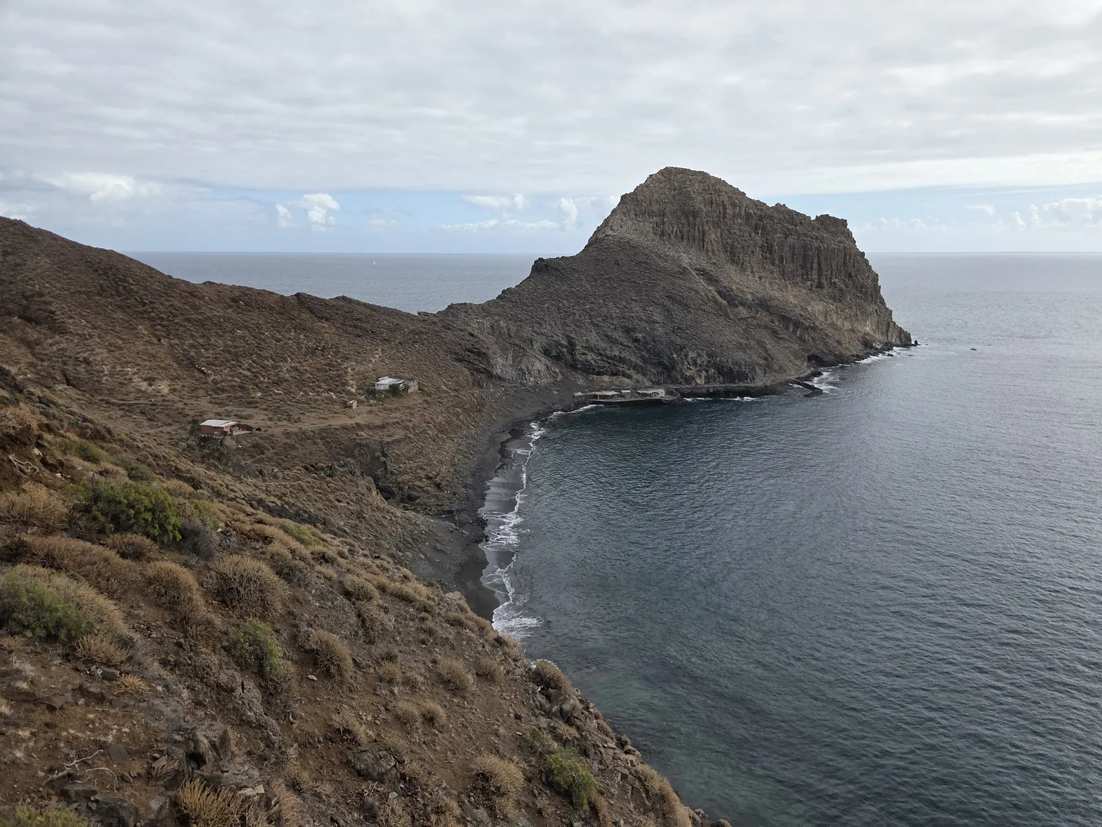
Where is Antequera Beach?
Antequera is on the southern coast of the Anaga massif, within the municipality of Santa Cruz de Tenerife. Igueste de San Andrés is the usual starting point for walkers, but the beach sits beyond the intervening ridges and ravines. It is not somewhere you can reach by driving a little farther along the coastal road.
The setting combines a curved shoreline, sparse hillside vegetation and a prominent rocky headland. Unlike Anaga’s misty forest interior, this coastal landscape feels open and dry, with exposed slopes descending directly towards the Atlantic. The contrast between the mountains and the sea is the main attraction.
Spain’s official beach directory lists a length of approximately 400 metres, although the amount of usable sand changes with the tide and sea conditions. Antequera particularly suits visitors interested in coastal scenery, photography and a day away from developed beach areas.
Getting to Antequera by boat
Arriving by sea avoids the strenuous mountain approach and gives you views of Anaga’s cliffs along the way. Tenerife’s tourism board identifies Santa Cruz and San Andrés as departure points for boat excursions to this stretch of coast. The actual boarding location depends on the operator and the service booked.
Náutica Nivaria advertises water-taxi services along the Anaga coast. Contact the operator before travelling to confirm that Antequera is being served on your date, together with the fare, minimum passenger requirements, landing arrangements and return time. Do not assume a boat will be waiting when you arrive.
A hike followed by a boat return can make an appealing one-way outing. However, it requires a confirmed collection and a realistic arrival margin. Ask what happens if sea conditions prevent pickup; a boat booking should not leave you dependent on an unplanned mountain walk late in the day.
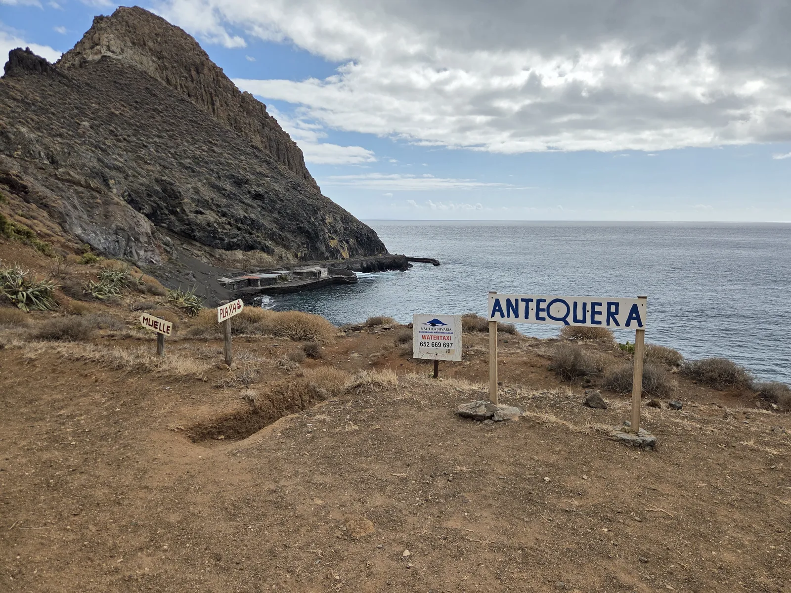
Hiking to Antequera from Igueste de San Andrés
The walking approach is a mountain hike with substantial climbing and descending. It is not a level coastal stroll. Expect uneven footing, stretches without shade and sections where confidence on narrow paths matters as much as general fitness.
Understand the different paths
Igueste connects with the official PR-TF 5 towards Chamorga and the PR-TF 5.1 towards El Semáforo. Neither route name, by itself, describes a complete signed walk to Antequera Beach. Beach itineraries use connecting paths and descents beyond those principal routes.
Common approaches involve the slopes above the El Semáforo route or a connection from the PR-TF 5 into the Antequera ravine. These should not be treated as interchangeable: the terrain, exposure and navigation differ. El Semáforo itself is a separate destination, so following its signs to the end does not automatically bring you to the beach.
Allow enough time for the whole outing
The Canary Islands tourism board gives roughly three hours for a walking approach from Igueste. Treat that as an indication of the commitment involved, rather than a guaranteed time. Your chosen route, pace, stops and conditions will affect the journey considerably.
If returning on foot, reserve the full day and leave enough daylight for the climb away from the shore. Download a suitable map and route beforehand, carry a charged phone, and check notices on Tenerife ON. A recorded track helps with navigation but does not establish that a path is currently passable. A local guide is useful if you lack experience on exposed, unfamiliar terrain.
Getting to Igueste: road access, parking and buses
Drivers approach Igueste de San Andrés via San Andrés and the coastal TF-121. The road reaches the village, not Antequera. Use permitted parking without obstructing entrances, narrow streets or turning areas, and allow time to walk through Igueste to your chosen trailhead.
TITSA route 945 connects Santa Cruz’s Intercambiador with Igueste via San Andrés. Check the timetable for your day, including the return departures: weekday and weekend services differ, and some journeys have a shorter operating route.
There is no bus stop or road parking at Antequera itself. If you hike from Igueste and return by boat to San Andrés or Santa Cruz, plan how you will retrieve your vehicle or continue home. This matters especially when combining separate bus and boat services.
Sand, swimming and facilities
Antequera has volcanic sand with stony stretches along the shore. Its appearance changes with light, moisture and the movement of sediment; the supplied photographs show dark sand bordered by rounded stones. Bring footwear that works for the approach rather than relying on beach sandals.
Tide height makes a significant difference to the space available. Lower water generally exposes more shore, while high water and swell can leave little dry sand. Choose a resting place beyond the reach of the waves and avoid settling directly beneath unstable rock faces.
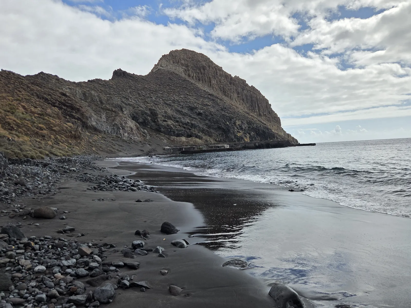
Do not equate an apparently sheltered bay with safe swimming. Waves and currents can make entering or leaving the water difficult, and Antequera has no lifeguard service. Follow any posted bathing prohibition or local instruction. In unsettled conditions, enjoy the landscape from dry ground.
Plan to be self-sufficient: there are no dependable beach facilities for buying food, refilling water, using toilets or hiring sunbeds. Carry everything you need and take all rubbish away. Naturism is associated with Antequera, so visitors may encounter both clothed and unclothed beachgoers.
When to visit and what to bring
Choose the day around the sea forecast and, if hiking, the mountain weather. Summer can offer calmer conditions at sea, but exposed climbs become more tiring in the heat. Cooler days may suit walking better, provided rain and strong winds are absent. Check AEMET’s marine forecast as well as the land forecast.
- Carry ample drinking water, lunch and an additional snack.
- Bring sun protection, a hat and suitable walking shoes.
- Pack a light extra layer, basic first-aid supplies and a headtorch for a hiking day.
- Protect your phone and valuables from spray on boat journeys.
For a boat visit, leave an unhurried window for the beach between your confirmed crossings. For a hiking visit, make Antequera the main objective of the day; adding El Semáforo or a longer Anaga traverse increases the commitment. San Andrés makes a practical stop for a meal afterwards. Choose the boat if your priority is the beach, and the walking approach if the mountain journey is an equally important part of the experience.